From Ushuaia to Bogotá – Over, Around and Through the Andes
Our transcontinental journey deepens respect for the iconic mountain chain.
Before we laid eyes on the mountain chain that dominates the western edge of South America, the Andes already took on a mythic quality in our family’s imagination because of a museum we visited in Montevideo, Uruguay.
The Andes 1972 Museum was barely noticeable on the way back to our apartment in Ciudad Vieja, but something made me turn around. What happened in 1972? I wondered. Why do they need a museum for it?
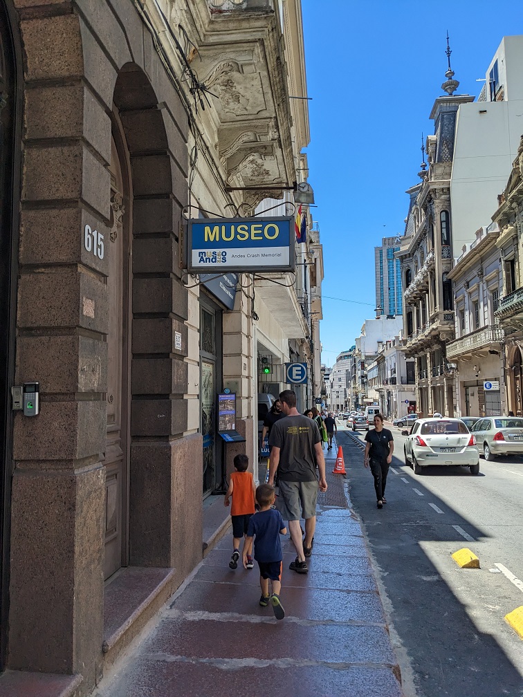
On October 1972, a flight from Mendoza, Argentina to Santiago, Chile struck a mountain while crossing the Cordillera (as the chain is affectionately referred to on the continent). The impact sheared off the wings and tail section while the fuselage slid down a glacier and crashed into the ice and snow beneath. Of the 45 passengers on board, 16 made it through the harrowing 72-day ordeal of high Andes survival (which involved, unpleasantly, survivors eating the remains of those who perished).
It was a rather morbid story for the kids to absorb. And absorb it they did, down to the items found among the wreckage later and displayed behind glass to commemorate those who died. “Do you remember that dollar bill? That shoe?” The boys still bring up odd details months later.
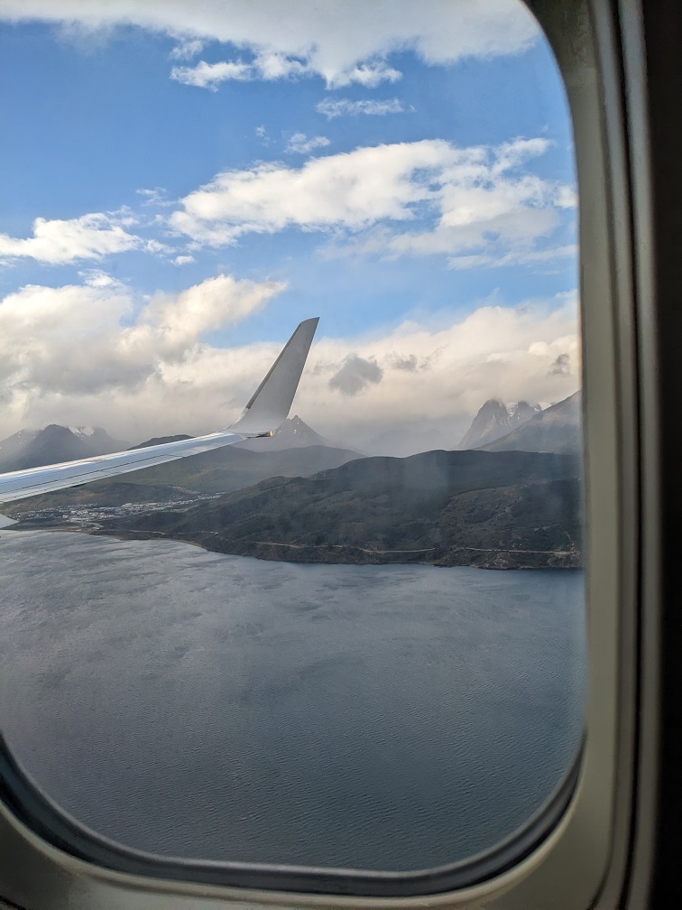
After the museum visit, we started speaking of “Crossing the Andes!” in hushed, epic tones. “At least we’re not stuck in the Andes!” became a go-to refrain for any minor inconvenience we encountered. In fact, we had our first meeting with the tail end of the Andes a week from the museum visit, on a flight from Buenos Aires to Ushuaia.
A “Long Way Up”
On January 1, 2023, our plane descended into Tierra del Fuego. We skirted white-capped mountain peaks that revealed isolated green valleys below. We experienced some of the worst turbulence in our lives, with stomach-flipping drops that raised the specter of us passengers ejected like confetti out of a crashing plane. That museum visit had given us lots of interesting scenarios to imagine. Thankfully, the pilots safely navigated the turbulent air pockets. But they seemed to have given up on any pretense of a smooth ride, abruptly dropping us onto the landing tarmac as if to say, “That’s it! We’re done with this ride!” We had arrived at the foot of the Andes.
The Andes Mountains are part of the same tectonic outcropping line that forms the western mountain ranges in North and Central America, from the Canadian Rockies, to the Rocky Mountains and Sierra Nevada, to the Sierra Madre in Central America. This entire grouping, called the American Cordillera, wends all the way into Antarctica.
The Andes in particular started forming about 180 million years ago as the Nazca Plate, on which a part of the Pacific Ocean floats, wedged itself underneath the South American plate. As one crust dived under the other (the technical term is subduction), the submerged crust melted and moved back up through the top crust, amid earthquakes and volcanic eruptions. This process formed what is now the longest mountain chain on the planet.
When we first planned this part of our trip, we were inspired by the 2020 documentary “Long Way Up,” featuring the Star Wars celebrity Ewan MacGregor and his friend Charley Boorman. They ride electric motorcycles from Ushuaia, at the southern tip of South America, 13,000 miles north to Los Angeles. Though we don’t have such a snazzy ride, we have patched together our own version of “Slow Camino Long Way Up.”
We’ve made our way north from Ushuaia along the western edge of South America by many long-distance buses, a ferry, and two plane rides. On the way, we’ve come to respect the power of the Andes mountain range, which dominates not only the visual landscape, but also the weather and the physical experience in this part of the world.
Glaciers, Volcanoes, and Earthquakes: Endless Worldschooling Inspiration
At the Torres del Paine National Park in Chile, we were hiking the Cuernos Lookout trail when we heard a crashing sound. Turning around, we watched piles of snow vertically detach from the peak of Cerro Paine Grande. An avalanche! (Don’t worry, we were very, very far away.)
Here at extreme south of the continent, elevated altitude from the geological forces beneath the earth has preserved a remnant of the last ice age, about 6,500 square miles of packed ice and snow forming several large glaciers, known as the Southern Patagonian Ice Field. This field reached its largest size 18,000 years ago, though today with a warming climate it is rapidly melting away.
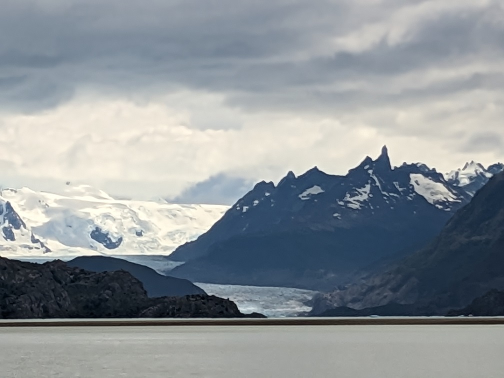
On the hike that day, we watched as the summer heat melted some of the snow accumulation, a microcosm of the larger climate changes portending the greater losses to come. Still, getting to see the edge of Grey Glacier and watching the avalanche was magical. Here we were looking at ice and drinking melted glacier water that had been frozen for millennia. We were experiencing another earth era.
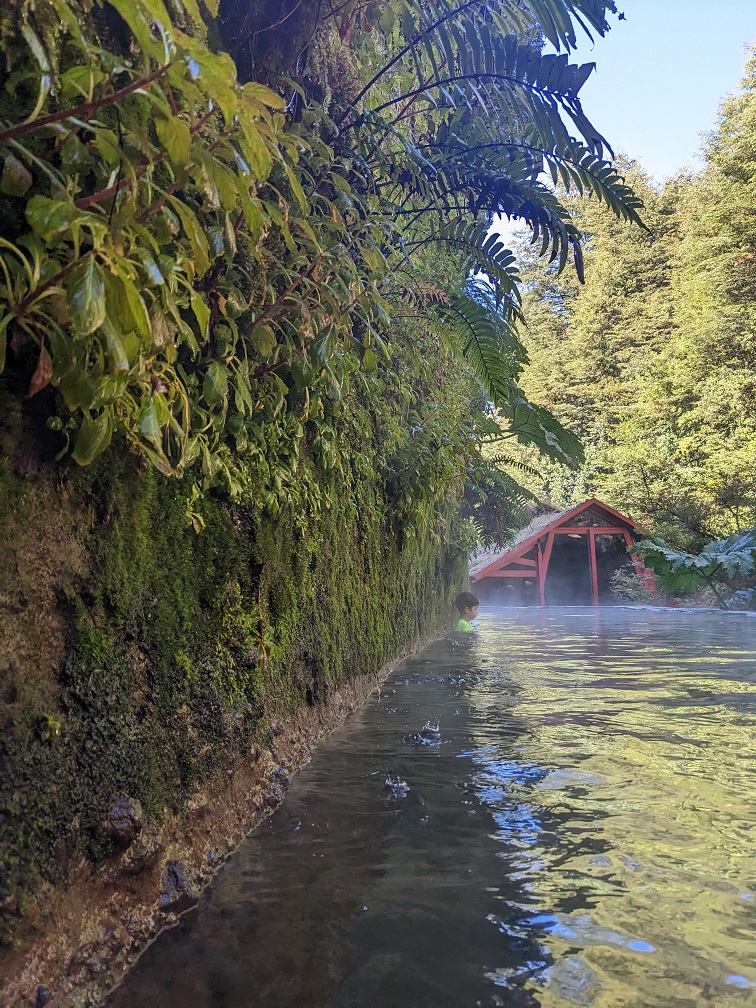
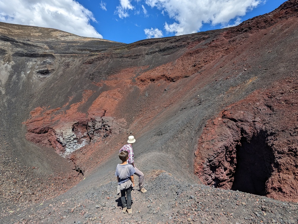
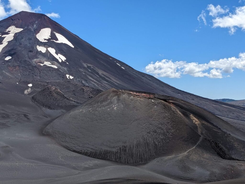
In the Los Rios and Araucania regions of Chile, we couldn’t help ooohing and aaahing at the perfectly conical volcanoes in the distance. Some, like Volcán Villarica, were literally the Platonic ideal of a volcano. We did some research, including a mini-course on plate tectonics, to understand how the many volcanoes and hot springs along our route formed. For some hands-on experiences, we soaked in one of these geothermal powered springs and climbed up the crater of a recently-birthed volcano, Crater Navidad. It formed in 1988 when a fissure at the base of Volcán Lonquimay erupted, creating a river of cooled lava the reached 10.2 kilometers northeast.
In Chile, earthquakes are common. The last major earthquake happened in 2010 with a magnitude of 8.8. Its epicenter was not far from where we stayed for two weeks on a farm. Our friends all had their own earthquake stories. One friend was on an overnight bus to Santiago, which stopped abruptly in the night. She knew something serious was up, but didn’t realize it was an earthquake until the morning, when the bus was still in the same position where it had stopped hours earlier. The bridge in front had collapsed. At least 525 people died in the quake, which caused a days-long blackout across the country. With no cell phone service, many wondered for days whether their loved ones were okay.
Earthquakes are another reminder of powerful forces beneath our tiny sliver of livable crust that floats on the hot magma center of our planet.
How the Andes Chain Affects South American Climates
The climate in Southern and Central Chile gave us another opportunity to appreciate the influence of the Andes. Like California, the region is located with the ocean to the west and the mountains to the east. All the moist air from the ocean gets trapped on the west side of the mountains, leaving the east side dry. Like Central Valley in California, this region of Chile is a prime agricultural zone, producing strawberries, blueberries, plums, cherries, wheat, oats, and more. When we crossed the mountain pass between Santiago, Chile to Mendoza, Argentina by bus, we got to see the dramatic landscape shift, from lush valleys on the Chilean side to dry scrub on the Argentine side.
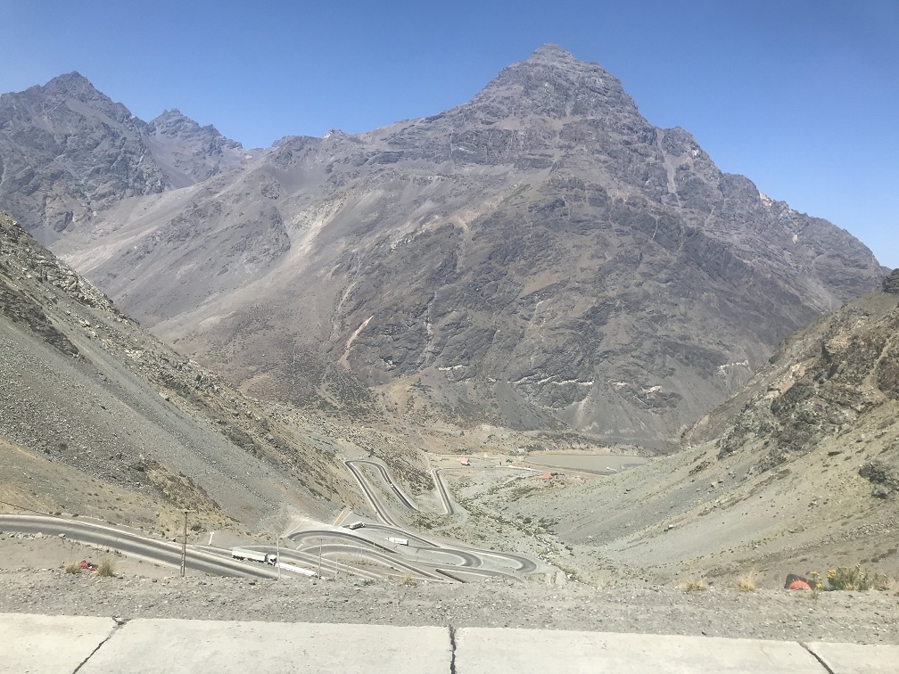
But when we took a flight from Mendoza to Salta, about 1000 kilometers (620 miles) north in Argentina, we noticed the landscape had reversed. Now, the dry land lay west of the Andes, in the Atacama Desert, known as the driest desert on earth. East of the mountains, where we were in Salta, the landscape was green and subtropical. What was going on?
It turns out that up here, the Amazon rainforest provides the moisture. But the Andes Mountains now block that moisture from going west, while another smaller, coastal offshoot of the American Cordillera blocks the ocean moisture, creating a pocket with the driest non-polar climate on earth, the Atacama Desert.
We attempted to explore a part of this dry patch, the Salt Flats of Uyuni in Bolivia, but the Andes (and lack of Bolivian visas) stopped us.
Andes and Altitude Sickness
On the 8-hour bus ride from Salta to La Quiaca, at the Argentina-Bolivia border, I made a quick Instagram story with Finley looking through the bus window at the llamas grazing. “Llegando El Altiplano: 3,507 meters (11,505 feet) and climbing.” It was fun to know we were this far from sea level…until the altitude sickness struck.
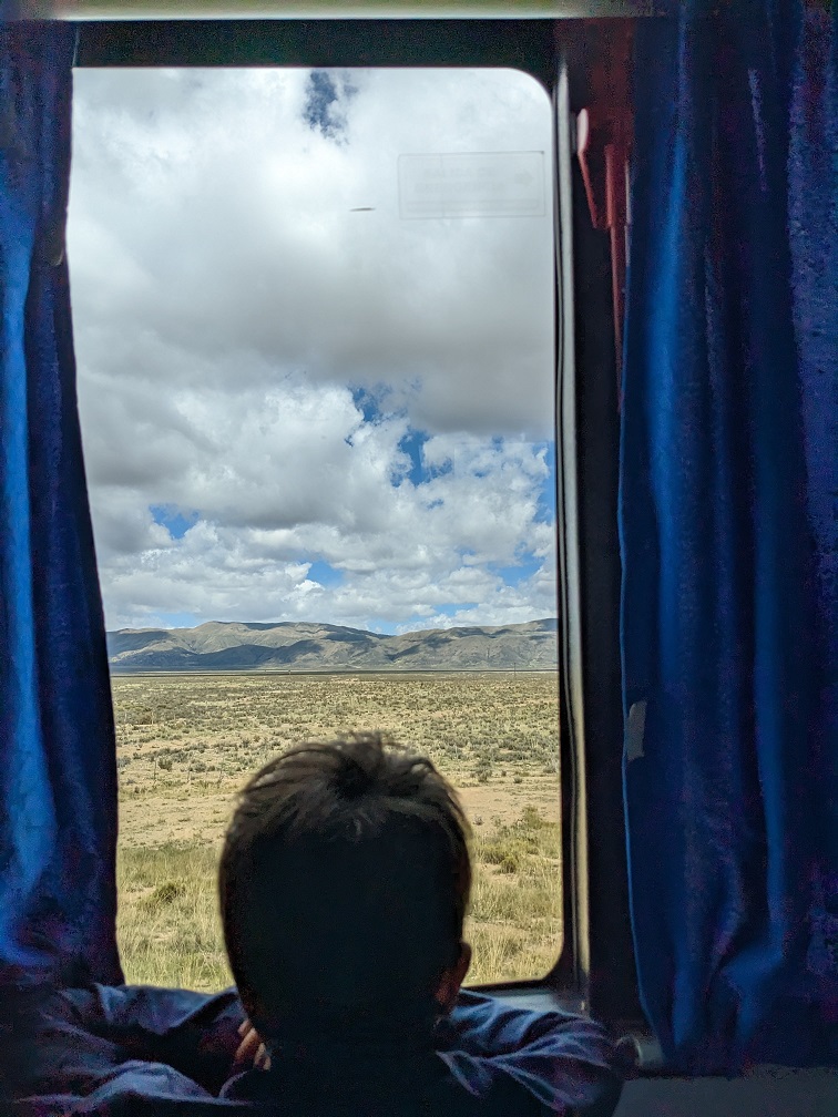
Matt wrote all about this episode in another post (as did Oliver), but suffice it to say that we were not prepared for the elevation. On “Long Way Up” Ewan MacGregor and one of his team members get quite ill in Bolivia, being so high up. One episode ends with MacGregor doubled over, head in hands. The hotel room door closes and we hear sounds of retching. Poor Obi-Wan. Still, I figured it was a small chance that same fate might strike someone in our family. Or, even if it did, that we’d get over it quickly.
Our oldest son’s altitude sickness lasted from about five minutes after I made that Instagram post to four days later, as we were finally figuring out our papers and getting ready to cross the border into Bolivia. In the meantime, I watched him violently throw up four times. Matt and I also endured an anxious night wondering if we should scrap our plans and bring him to lower altitude, haunted by my late-night Googling on when altitude sickness can become lethal. I had underestimated the power of the Andes.
The Altiplano is one of two super-elevated flatlands in the world, the other being the Tibetan Plateau. It is what one science article calls the “high altitude heart of the Andes,” a stretch of plains cradled between two Cordillera branches, with elevations averaging 3,800 meters (about 12,500 feet) above sea level.
Here, the climate is unforgiving. The sun’s harsh rays are not softened through layers of protective atmosphere and the air thins to an almost unbreathable dribble of oxygen. Your body must learn to make more red blood cells to make up for the lack of oxygen. Until it does, you suffer.
We’ve since adjusted. We have also come down to a slightly lower altitude while staying on a farm in Mizque, Bolivia. Coming up on our itinerary is La Paz, the world’s highest national capital. Matt has told me that whatever gains your body makes to adjust for altitude, it loses soon after you go to a lower level. So it appears we may be in for another bout of sickness.
From La Paz, we’re heading to Bogotá, another high-altitude capital in Colombia. By then we will have made it from the very south of the Andes chain to the very north, traversing the continent.
While we haven’t had to survive months in a crashed plane fuselage, our journey has brought us into a deeper relationship with this behemoth mountain chain. From glaciers to volcanoes to high plains, the Cordillera commands respect and elicits wonder at the hidden planetary processes that shape the landscape and our lives.
Written and illustrated by the authors of this blog.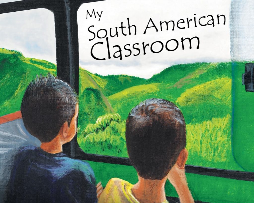
A Book for Little Travelers
A True Story From Our Gap Year